- Home
- Research
- Quantum Systems
- Research results
- Development of high-resolution geophysical measurement technology for interdisciplinary geoarchaeological research
Development of high-resolution geophysical measurement technology for interdisciplinary geoarchaeological research
04.11.2019
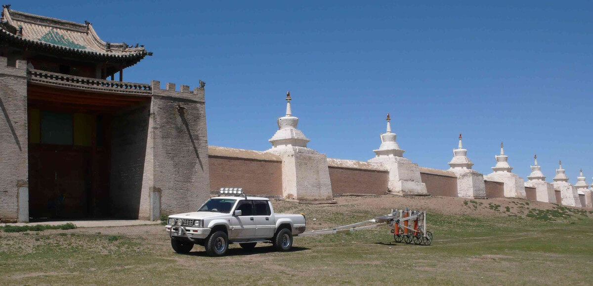
Quantum sensor-based geomagnetic measurement systems are characterized by a unique combination of resolution, speed and information density.
This enables the efficient, non-invasive and high-resolution imaging of archaeological structures of large settlement areas and ground monuments hidden in the ground. At the same time, it is possible to calculate back to the magnetic sources, i.e. to model the depth and geometry of archaeological objects.
A motorized measuring instrument developed in the Department of Magnetometry is currently the core of several geoarchaeological research projects. A DFG project with the University of Bonn aims at the complete magnetic and topographic survey of the first capital of the Mongolian Empire – Karakorum. Within the DFG Priority Programme 1630 Ports – from the Roman Imperial Period to the Middle Ages, the measuring instrument is used to investigate the course of the Karlsgraben in southern Germany. Canal construction under Charlemagne is one of the most important major hydraulic engineering projects of the early Middle Ages. The interdisciplinary research team includes the Universities of Jena, Leipzig and Kiel as well as the Bavarian State Office for Monument Conservation.